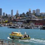
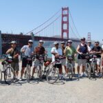
REVIEW · SAN FRANCISCO
Highway 1 Pacific Coast Highway Self-Guided Driving Tour Bundle
Book on Viator →Operated by Drive with Action · Bookable on Viator
Highway 1 sounds better with an audio guide. This self-led drive uses location-triggered narration so you can move through California’s coast with less stress and more context. You’re in charge of the pace, from roadside pull-offs to photo stops, with the app guiding you from San Francisco down to Santa Monica.
Two things I like a lot: the offline GPS works without cellular or Wi‑Fi, and it’s good value per car (priced per group up to 4). I also like that the narration runs hands-free, so you can keep both hands on the wheel and your eyes on the road.
One thing to consider: if you drift off the route or miss the next trigger point, the audio can feel out of sync. This is still very doable, but you’ll want a phone mount or a quick glance at your screen now and then to stay aligned with the plan.
In This Review
- Key things to know before you hit play
- Value and pace on California’s Highway 1
- The app, offline GPS, and how to keep audio in sync
- From Pacifica to Half Moon Bay: bay history, bunker views, and whale season
- Pigeon Point, redwoods, and Santa Cruz critter watching
- Big Sur in one long day: bridges, lighthouses, and purple sand
- Central Coast small towns: weird landmarks, monarchs, and surf energy
- From Santa Barbara to Santa Monica: beaches, cliffs, and a clean finish
- Should you book this Highway 1 Highway 1 audio tour?
- FAQ
- How long does the Highway 1 self-guided tour take?
- Does the audio guide work offline?
- What does the price cover?
- Are entrance fees included for the attractions?
- Where do I start and where do I finish?
- How do I start the tour when I arrive?
Key things to know before you hit play
- Offline GPS after download means you can keep going even when service drops off
- Hands-free audio plays automatically based on your location, so you’re not constantly tapping
- Buy once, use for a year if you want to repeat pieces or revisit later
- Many stops are pull-offs with short walks, so you can sample without losing the whole day
- A few spots are not included for entry, so plan on using your own tickets if you choose to go in
- The route needs attention: light guidance plus auto audio works best when you stay on pace
Value and pace on California’s Highway 1
This tour is built for one of those road trips that’s easier than you think, as long as you respect how long the drive is. The guide covers Highway 1 essentials in about 5–7 hours for the core run, but the full experience often lands closer to 10–11 hours when you add story stops, quick walks, and extra photo time.
The price is the real head-turner. It’s $29.99 per group for up to 4 people, not per person. That’s a big deal if you’re traveling with friends or family and you’d rather split one cost than pay for separate audio apps, parking add-ons, or bus-style group tours.
Also, your purchase has staying power. The narration is valid for an entire year, which means you can use it on an extended trip, come back for a second look, or start over if you want a different rhythm through the coast.
You can also read our reviews of more guided tours in San Francisco


The app, offline GPS, and how to keep audio in sync
You’ll use the Action’s Tour Guide App on your phone. After booking, you get an email and text with a password and setup instructions, and you’ll need to download the tour while you’re on strong Wi‑Fi or cellular. After that download, the audio and offline GPS are supposed to keep working even when you lose service.
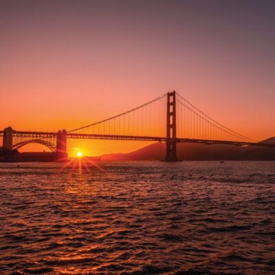
Once you’re onsite, no one meets you at the start. You go to the starting point near San Francisco—PG6H+8F San Francisco (Lakeshore, San Francisco, CA)—then open the Action app and choose the correct tour direction. The audio is location-triggered, so it’s meant to start by itself and roll into the next story.
Practical tip: connect your phone to your car stereo if you can. Even with hands-free playback, having clear audio without balancing volume between windows is a quality-of-life win. And since the guide expects you to follow the route at a reasonable pace, keep an eye on the speed limit and the recommended driving rhythm. If you slow way down, speed up, or take a detour without checking what’s next, you may feel the story cues lag behind.
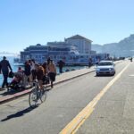
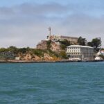
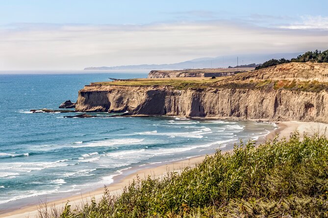
From Pacifica to Half Moon Bay: bay history, bunker views, and whale season
Your road trip starts in San Francisco’s orbit and quickly turns into coastal geography. The first stop is Pacifica, where the narration sets the stage for San Francisco Bay history and even brings up the Spanish explorer Gaspar de Portolá. You’ll also hear the unusual story behind the town’s name—these are the kind of details that make a “passing through” feel like a real introduction.
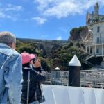
Next up is Pedro Point, a rocky outcrop with dramatic ocean views. It’s only accessible on foot via a path that becomes usable at low tide, which is exactly the sort of stop where having timing awareness matters. If you love a short hike with a strong payoff, this one fits.
Then you hit Devil’s Slide Trail, a World War II-era bunker built to watch the horizon for possible invasion threats. Today it’s a hangout for local youth and graffiti artists. Even if you only do a quick stop, it’s a reminder that Highway 1 isn’t just pretty—it has layers.
From there, Gray Whale Cove State Beach is a big seasonal star. If you visit in December and January, gray whales migrate south past this shore, and they’re sometimes close enough to spot with the naked eye. If you’re traveling outside those months, you may still enjoy the coastal stop, just don’t plan the day around a whale sighting.
You’ll also pass through Montara, described as a rustic town tied to an old lighthouse. Then it’s on to Half Moon Bay, a “sleepy seaside town” with a surprising past linked to mob activity and the dark side of local history.
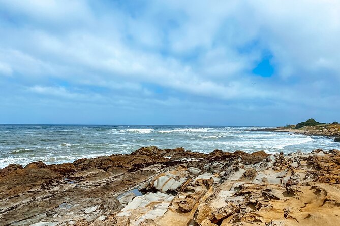
Quick breaks keep the energy up: Bean Hollow State Beach is humble but scenic, and it’s the kind of place that works well when you just want a reset.
Pigeon Point, redwoods, and Santa Cruz critter watching
A standout photo stop comes next at Pigeon Point Lighthouse. At 115 feet tall, it’s listed as the tallest lighthouse on the west coast and also one of the oldest. If you’ve been waiting for that “classic coast lighthouse” shot, this is the moment.
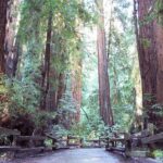
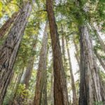
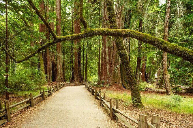
After that, the guide turns toward redwoods. You’ll pass lush redwood groves and then drive through Big Basin Redwoods State Park, where old growth trees and a lush canopy dominate the view. If you’re traveling in the morning, the guide notes you might get wildlife sightings, which is worth planning for if you can.
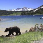
There’s also a wildlife-focused stop around elephant seals, with the best viewing months between December and April during their breeding season. You’re not just watching scenery here—you’re watching a whole coastal ecosystem put on a show on its own schedule.
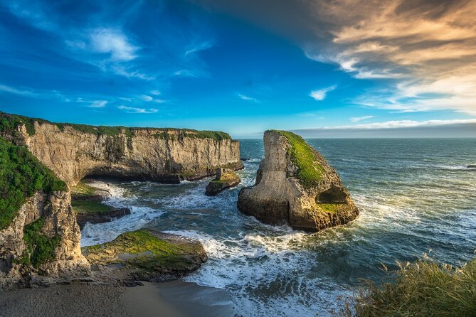
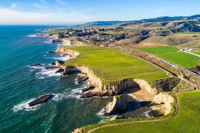
Now you reach Davenport, a tiny town known for pristine beaches. One named landmark is the Davenport Crack, where water carved a deep tunnel through a cliff so it looks like the land split in two. Nearby, you’ll also pass a “shark fin” rock formation cove (the guide notes you don’t need to worry about actual sharks), plus pocket beaches that are small, secluded, and need a bit of scrabbling to reach—so they tend to be less crowded.
Then it’s Santa Cruz, one of the must-see towns on this run. The guide calls it picture-perfect, founded in 1791, with quirky shops and great food. A key stop is Santa Cruz Wharf, known for seafood and an amusement area with a fully functional wooden roller coaster.
If you want something odd and fun, The Mystery Spot is included near Santa Cruz. It opened in 1939 by George Prather and uses short demonstrations that appear to defy gravity, inside and outside the building.
Sunset lovers get their moment too at Sunset State Beach, and nature fans can look toward Elkhorn Slough Reserve, a wetland where salt water meets fresh water, supporting 700+ species. The tour also references the historical boom in sardines and what changed that story along this stretch.
Finally in this section, you reach Monterey, once the center of the sardine-packing industry. The narration points you to Cannery Row, now packed with seafood restaurants, gift shops, and bars in converted factory spaces. It also flags the Monterey Bay Aquarium, with thousands of marine animals and plants in underwater and interactive exhibits (entry itself isn’t included, so this is mainly for context and timing).
Big Sur in one long day: bridges, lighthouses, and purple sand
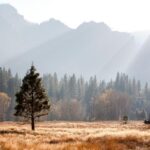
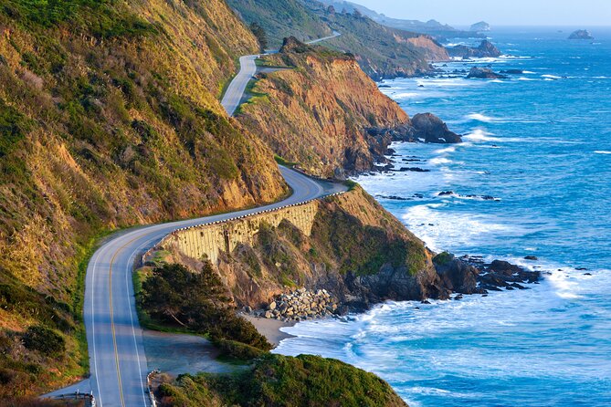
Once you’re in Big Sur, the guide doesn’t pretend you’re staying in a simple coastal lane. It describes the iconic stretch with bluffs rising hundreds of feet above crashing waves, lush greenery, and rugged hiking trails. This is the part of Highway 1 that makes people say yes to a car trip they swore would be “too long.”
Near Big Sur, you’ll pass the 17-Mile Drive detour through Pebble Beach and Pacific Grove, with ocean views on one side and estate areas on the other. It’s a nice “change of pace” within the larger drive.
Then comes Carmel-by-the-Sea, a picture-perfect village known for fairytale cottages and art galleries. You’ll also get a coastal stop nearby: a white-sand beach beside a cypress grove, a place locals come to surf, walk dogs, and watch sunsets.
The guide also mentions a reserve in the Carmel area with lots of marine and terrestrial animals and notes it’s a solid option for scuba diving if you want wildlife-close experiences.
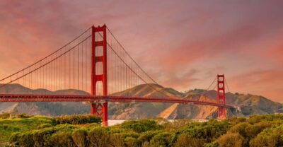
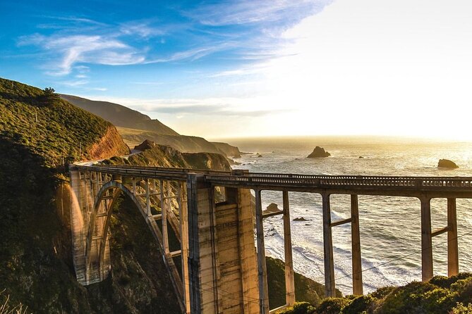
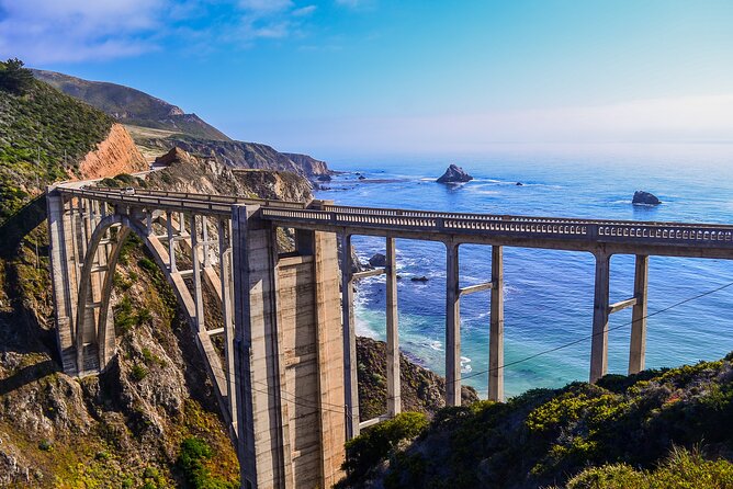
For classic Big Sur hiking atmosphere, there’s Garrapata State Park (entry not included). After that, brace for one of the most photographed crossings in the state: Bixby Creek Bridge. The narration calls out its concrete arch shape and how the bridge and ocean views create a unique crossing moment.
You’ll then cruise past Point Sur Lighthouse, described as an island lighthouse that once caused nightmares for ships at night and later was placed on the National Register of Historic Places. The guide also notes that former landowners blocked almost any development along that coastline stretch, which is why the wilderness feels so intact.
More bridge scenery follows: a “handsome bridge” built as a new replacement after a landslide in 2017 is part of the story. Then you get a real signature beach moment at Pfeiffer Beach, famous for purple sand caused by manganese garnet washed down from nearby bluffs.
For marine mammal viewing, the guide points you to Seal Beach Overlook, with a very good chance of spotting California’s favorite marine mammals lounging on shore rocks.
You also reach Partington Cove, a sheltered, secluded cove tied in the guide to moonshiners during Prohibition. Nearby, there’s an 80-foot waterfall story: it once cascaded into the Pacific, but mudslides changed the landscape permanently. It’s still an impressive stop for the view and the backstory.
Other Big Sur highlights keep stacking: Big Creek Bridge (with turnouts at each end), Limekiln State Park with four historic 19th-century lime kilns, and Pitkins Curve Bridge, a rockslide-protection structure that includes a protective shed. If you love odd engineering, this is for you.
Then there’s jade. The guide describes a secluded cove where a prospecting rush once pulled up jade, and where visitors can still find small pieces. You’ll also pass through an old-growth redwood grove and hear that some giants can grow up to 350 feet.
For pure coastal drama, you’ll pass Ragged Point, described as extremely scenic with bluffs up to 400 feet and minimal development. There’s also mention of a popular rustic inn right there—often a stop people use for a bite if they’re staying in the area long enough. The guide then signals an unusual lighthouse you’ll pass that looks like its top was cut off.
Elephant seal viewing returns with Elephant Seal Vista Point, where the guide notes you’re almost guaranteed to see seals crowding the rocks, plus it mentions an accessible walkway. For a stop built around a wildlife “watch and wait” moment, that’s a good fit.
You’ll wrap the Big Sur stretch feeling like you still have more. Then you head into Moonstone Beach Drive, a detour with a boardwalk where you can stretch your legs before continuing.
You can also read our reviews of more tours and experiences in San Francisco


Central Coast small towns: weird landmarks, monarchs, and surf energy
After the Big Sur wildlife and coastline stops, the Central Coast shift feels like exhale. You’ll pass Nitt Witt Ridge, described as a reclusive artist Arthur Beal’s house made mostly from trash, strange but oddly beautiful.
Then it’s onward to Harmony, a tiny place listed at just 18 people in the last census count. It’s the kind of stop that’s more about watching how few humans live along the coast than about a single attraction.
Next, Cayucos gives you old-timey Wild West vibes with saloons and antique shops. After that, Morro Bay centers on Morro Rock, a volcanic plug rising 600 feet out of the water and a nesting place for peregrine falcons.
A bigger hub appears at San Luis Obispo, described as green, flower-filled, and almost impossibly pleasant. For oddball roadside fun, you’ll hit Bubblegum Alley, where visitors have covered the alley walls in bubble gum over time.
The guide also references a former mining area tied to chromium and mercury, now turned into a place with over 8 miles of hiking and mountain biking trails. Then you reach Avila Beach, which has a dark past tied to an oil company demolishing the town and later rebuilding it. Nearby, Dinosaur Caves Park doesn’t have dinosaurs or caves, but it’s still listed as a nice picnic stop with an explanation for its name.
At Pismo Beach, the guide notes historic missionary landings. There’s also a seasonally perfect stop for nature lovers: monarch butterflies in eucalyptus trees between October and February, with around 25,000 butterflies sheltering in the area.
Then you reach Guadalupe, a small, quiet break spot, plus a dunes area described as the tallest on the entire west coast, reaching up to 500 feet. You’ll get Lompoc, known for tens of thousands of flowers and murals (with 40 murals honoring past and present scenes). Wine fans also get a mention: the Lompoc Wine Ghetto has a world-class collection of wineries and tasting rooms.
The guide offers an optional alternative beach: Jalama Beach, described as quieter and off the beaten path. Then it cycles back to photo stop energy at a vista point, followed by Refugio State Beach with white sand, palm trees, and very blue water.
Monarchs aren’t done either. The guide mentions another butterfly grove similar to the monarch stop earlier, but adds that eucalyptus trees have been struggling and the butterflies are present in fewer numbers than usual. If you’re traveling in November to February, it’s still flagged as a must-see.
From Santa Barbara to Santa Monica: beaches, cliffs, and a clean finish
At Santa Barbara, the guide calls it one of California’s prettiest towns, with Spanish mission origins and a modern mix of artists, high-end restaurants, and idyllic beaches. You’ll pass Thousand Steps Beach, corrected to note there are 218 steps down to the shore.
Next is Carpinteria State Beach, described as good for swimming and camping, with a “hidden trick”: harbor seals. Then you get surf-famous names: Rincon Beach, noted for the Rincon Classic competition, and Faria Beach, another surfing spot near Las Pitas Point. The guide warns that the sand space can be limited, which is more for you to consider if you’re more about shoreline downtime than surfing.
Then comes Ventura, a seaside city with character and restaurants along a boardwalk. You’ll also pass Point Mugu Rock, where early engineers had major problems building the highway, and now it’s a great pull-over to look at the coastline. There’s Sycamore Cove Beach for campers, plus a mention that it includes picnic tables and grills.
For rock-and-photo energy, you’ll reach El Matador State Beach, described as defined by weird rock formations, with sunset noted as the absolute best time to visit. After that it’s Point Dume, paired with Zuma Beach and Malibu, both framed as favorite beach getaways for Los Angeles residents with iconic coastline views and strong surfing opportunities.
The finish is Santa Monica, right by the Santa Monica Pier, where your tour ends. The guide frames this as the place to close the loop: beach time, pier energy, and a smooth transition into Los Angeles once you park.
Should you book this Highway 1 Highway 1 audio tour?
I’d book it if you want a road trip that’s flexible but not vague. The combination of offline GPS, hands-free narration, and one purchase per car makes it a smart choice for groups and for drivers who don’t want to babysit their phone constantly.
I’d think twice if you hate driving while checking cues at all. The tour is designed for following its sequence and staying on the route at a workable pace, and a few travelers have found that minimal navigation can make it easy to miss exact pull-offs.
If you’re okay with that tradeoff, this is a great way to turn “we saw the coast” into “we understood what we were seeing,” from Gaspar de Portolá’s bay history to elephant seals at a dedicated viewing point.
FAQ
How long does the Highway 1 self-guided tour take?
The experience is listed as about 10 to 11 hours. The guide notes the core Highway 1 essentials portion can take 5–7 hours for a 555-mile run.
Does the audio guide work offline?
Yes. After downloading on strong Wi‑Fi or cellular, the app’s GPS functionality and audio are designed to work offline without cellular or Wi‑Fi.
What does the price cover?
It costs $29.99 per group (up to 4 people) and is purchased per car/group, not per person.
Are entrance fees included for the attractions?
No. The tour includes narration and route guidance, but attraction passes, entry tickets, or reservations are not included.
Where do I start and where do I finish?
Start: PG6H+8F San Francisco (Lakeshore, San Francisco, CA).
End: 108 Santa Monica Pier, Santa Monica, CA 90401.
How do I start the tour when I arrive?
Open the Action’s Tour Guide App onsite, pick the tour version that matches your planned starting point and direction, then go to the first story point. The audio is designed to begin automatically and play hands-free based on location.